Bombay and Chuma
There would have been few successful African expeditions by Europeans without their African caravan leaders. These were the men who found porters, organized their loads, managed the order of the men and pack animals during the daily treks, interpreted for the expedition leader when they encountered native groups speaking different dialects and languages, and drew upon their local geographical knowledge for help in determining which paths the caravans should take. Two of these men bear special mention: Sidi Mubarak, who went by the name of Bombay, and Chuma.
Bombay was the Swahili-speaking guide who proved indispensable to Burton and Speke in their lake region expedition of 1857-1859 and to Speke and Grant in their search for Nile sources in 1860-1863. Incredibly, he was also hired in 1871 by Stanley during his search for Livingstone and by Cameron in 1873 for his transcontinental trip. Thus he had a major role in four of the most important European explorations of Africa. He was pensioned by the Royal Geographical Society in 1878.
Freed as a boy by Livingstone from a slave gang near Lake Shirwa in 1861, Chuma became one of the explorer’s most loyal companions. Livingstone left Chuma in the care of Dr. John Wilson, head of the Free Church of Scotland Mission School in Bombay, after sailing the Lady Nyassa across the Indian Ocean in 1864, but he picked him up again about eighteen months later when he returned to Africa for the last time. Chuma was still with Livingstone when he died in 1873 and was the one responsible for bringing the missionary’s body back to Zanzibar, eight hundred miles away. Later, Chuma accompanied Johnston and Thomson during their surveying of routes to the lake region in 1878-1880.

Bombay (seated)
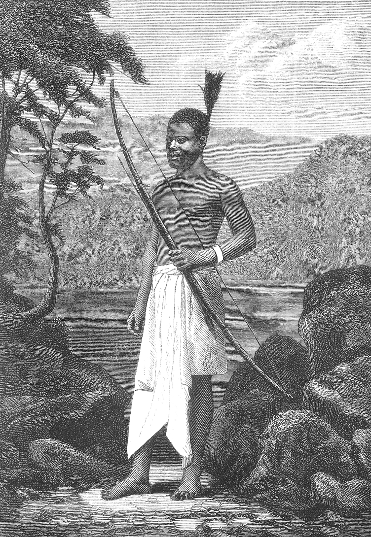
Chuma
Brussels Geographic Conference (12-14 September 1876)
In 1876, deciding that a turning point had been reached—the major exploration of Africa was nearing completion and a new phase of commercial and philanthropic opportunities beckoned—King Leopold II of Belgium called for an international conference to take place in Brussels to coordinate the European advance into Africa. Invitations were sent to all the leading geographic societies of Europe, and the resulting gathering became known as the Brussels Geographic Conference. It is ironic that one of the smallest and weakest European powers, with the least international experience, spearheaded this effort, setting in motion a cascading set of actions that would further “darken” Africa’s history.
In his opening address, delivered on 12 September 1876, Leopold stressed the importance of eliminating the slave trade and opening up the continent to the benefits of commerce and culture. The explorers had shown the potential, and some of them (Cameron, Grant, Nachtigal, Rohlfs, Schweinfurth) attended the conference to provide specifics. The king suggested as a first step the establishment of a chain of “scientific and hospitable” stations across central Africa, which explorers, traders, missionaries, and scientists could use as bases for their work. The national delegations agreed to a compromise of four such stations that could be linked by water, telegraph, or road.
The International African Association was created to govern and implement the plan. National committees were formed in Austria, Belgium, Great Britain, Holland, Italy, Portugal, Spain, Switzerland, Russia, and the United States to solicit funds and to organize projects for Africa. In most cases, however, these national committees soon ignored their communal role to pursue independent goals; very few contributed any money to the association. As a result, it soon became King Leopold’s private concern.
In Great Britain, the Royal Geographical Society, which had sent the British delegates to the conference, created the African Exploration Fund in 1877. Given its charter’s emphasis on scientific advancement, the RGS decided it could promote only exploration work. Enthusiasm for King Leopold’s plan rapidly waned in the following years as reports arrived of Belgian commercial activities in Africa (and the king’s employment of Stanley). Unable to raise much money, the RGS African Exploration Fund supported only one expedition, that of Johnston and Thomson, who surveyed (1878-1880) a possible route between Mombassa and Lake Victoria for future road or telegraph access to the central lake region.
The Berlin Conference (or “Congo Conference”) of 1884-1885
After Stanley labeled much of the last terra incognita on the map of Africa in the 1870s, the continent became totally vulnerable to the imperial aspirations of European countries. Seeking to regulate their colonization and trade in Africa, German Chancellor Otto von Bismarck invited representatives from Austria-Hungary, Belgium, Denmark, France, Great Britain, Italy, the Netherlands, Portugal, Russia, Spain, Sweden-Norway, and the Ottoman Empire to a conference to work out the necessary policy. The delegates met in Berlin from 15 November 1884 through 26 February 1885. The General Act of the Berlin Conference formalized several points: powers could only possess colonies if they maintained sufficient authority to administer and defend them; the Niger and Congo rivers were free and open to the traffic of trade; the Congo Free State was the private property of the Congo Society; any new act of possession along the African coast would not be recognized unless reported to the other signatory powers. The phrase “spheres of influence” made its first appearance in an international agreement.
The “scramble for Africa,” as historians have called it, had begun.