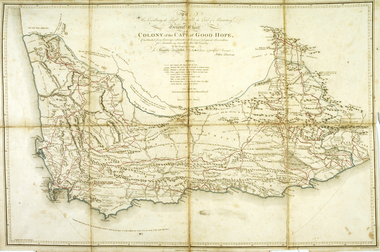
". . . This General Chart of Colony of the Cape of Good Hope, Constructed from bearings, estimation of distances & frequent observations for Latitudes in travelling thro' the Country in the Years 1797 & 1798. . ."

"Military Plan of the Cape Peninsula"

"Coast of Africa from Table Bay at the Cape of Good Hope, to Saldanha Bay"