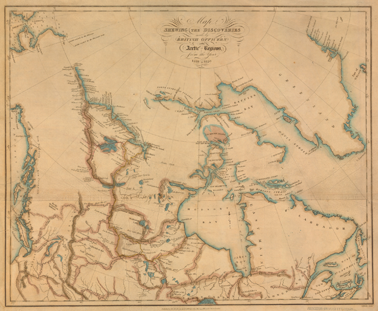
The nineteenth century belonged to the British in respect to exploration of today's Canadian Arctic. After the Napoleonic Wars (1800-1815), the British Navy dominated the seas, and until the Crimean War (1853-1856) its ships were often available for nonmilitary objectives. As second secretary of the Admiralty from 1804 to 1845, Sir John Barrow was the government leader in sponsoring expeditions to solve the puzzle of the Northwest Passage. The “discoveries” of this summary map were the results of an expedition commanded by Sir James Ross, and two each by Sir John Franklin and Sir William Edward Parry. These men formed part of the group of English explorers later called “Barrow’s Boys.” The map illustrates the increased precision and scale of these expedition maps.