|
|
|
|
|
|
|
|
|
|

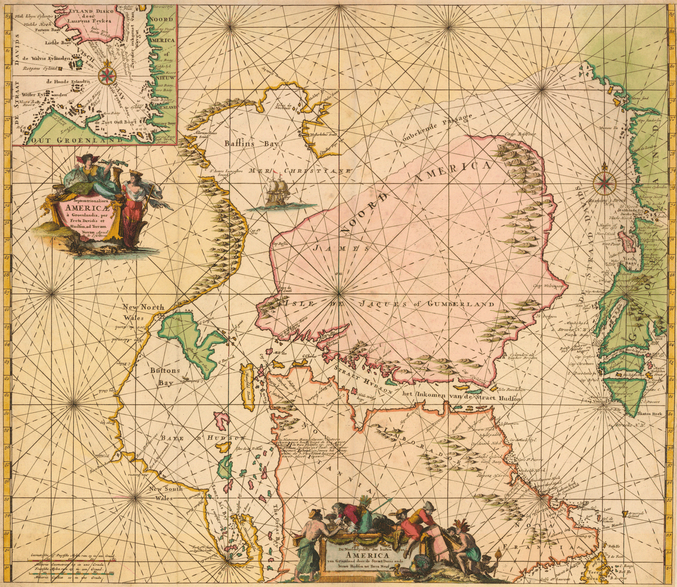
Ottens, J. (Josua), 1704-1765; Ottens, R. (Reinier), 1698-1750.
"Septentrionaliora Americæ à Groenlandia, pre Freta Davidis
et Hudson, ad Terram Novam" [1745]. Copperplate map, 47.9 x 54 cm., handcolored,
with inset of Disko Bay on Greenland. Fourth state, from their Atlas
van zeevaart en koophandel door de geheele weereldt (Amsterdam, 1745).
[Historic Maps Collection: purchased with funds provided by Robert M. Backes,
Class of 1939.]
This is the final state of a chart published by Frederik de Wit in 1675, which itself can be traced back to charts issued separately by J. van Loon and Pieter Goos in 1666. Hence, its cartography is almost 80 years old, additional place-names, half Dutch and half English, and an inset map in the upper left being the major differences. The onbekende Passage ("unknown passage") between Davis Strait and Baffin Bay at the top had actually been explored and more accurately charted by Baffin over 100 years earlier, but one must remember that his 1616 discoveries had been largely ignored or distorted by cartographers because of Samuel Purchas's incomplete publication of them. Similarly, the strange and erroneous northern link between Baffin Bay and Hudson Bay continues to be featured, even exaggerated, here, as on earlier maps. One interesting feature, however, unseen in the maps on the previous pages, is a depiction of the New and Old Worlds interacting in the bottom cartouche: Europeans trading with natives. It is clear who has the upper hand (and for whom the map is intended). The turkey's presence in the image is a curious choice, for, while it is a representative North American bird, it is unlikely to be found in any numbers at these latitudes.