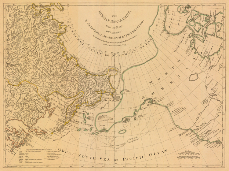
"The Russian Discoveries, from the Map Published by the Imperial Academy of St. Petersburg" (1775). Copperplate map, 43.6 x 55.6 cm., with outline color. From Thomas Jefferys's American Atlas (London, 1776). [Historic Maps Collection]
This map, published at the time of the American Revolution, graphically divides the speculative nature of North American cartography, particularly that associated with the Pacific Northwest and the northern part of the North American continent, from the advanced state of Russian mapmaking dealing with the eastern and northern coasts of Asia. Hindering the former was the prevalence of several longstanding Northwest Passage myths, the most prominent one surrounding the fictional character of Admiral de Fonte. [See the section devoted to "Speculative Cartography" for more on this subject.] On his map, however, Sayer only grudgingly acknowledges de Fonte ("according to the pretended Journal of Admiral de Fonte"), preferring to leave his North America virtually blank.