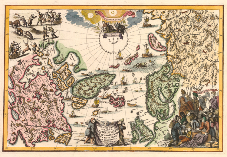
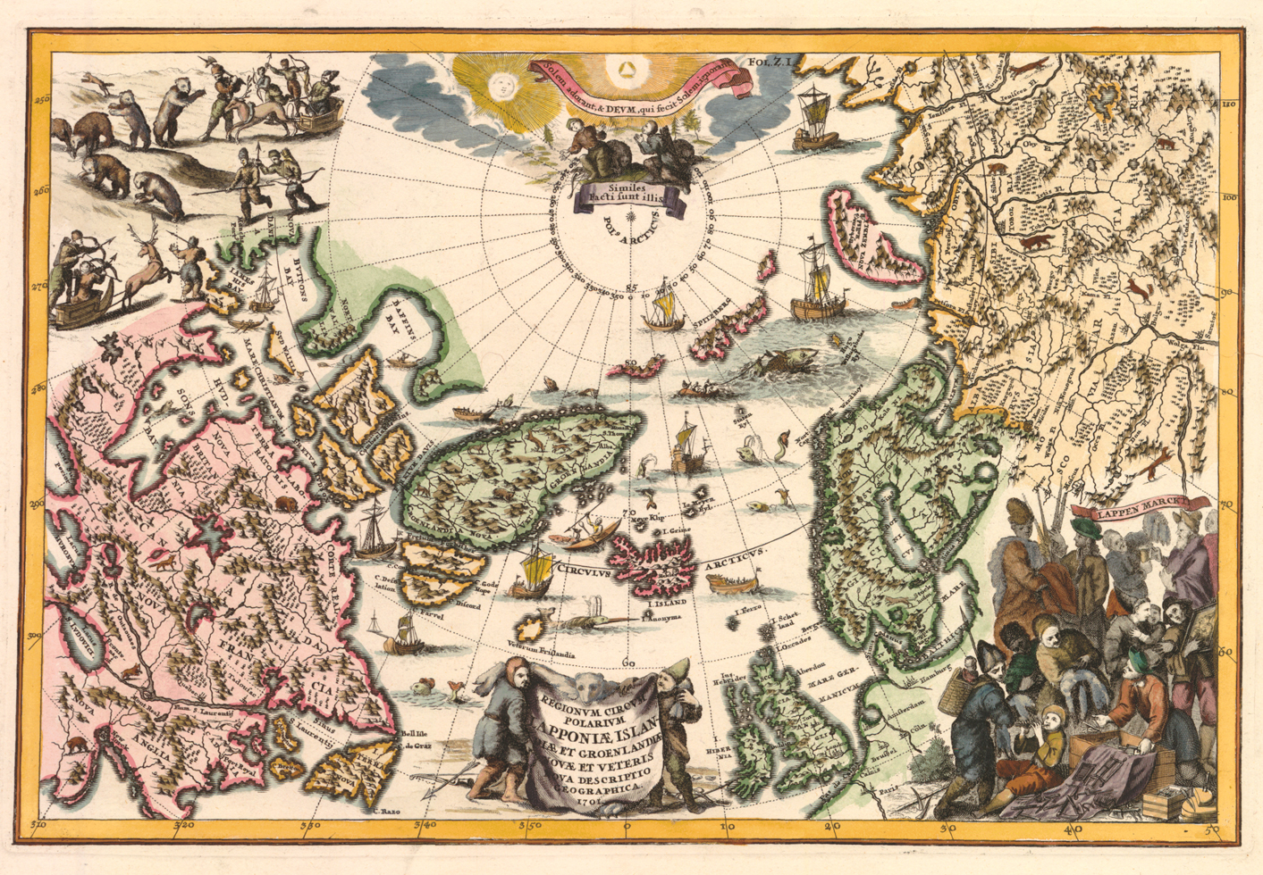
"Regionum Circum Polarium Lapponiæ Islandiæ Et Groenlandiæ Novae Et Veteris Nova Descriptio Geographica." Copperplate map, 21.7 x 33.2 cm., handcolored. [Historic Maps Collection: purchased with funds provided by Robert M. Backes, Class of 1939.]
This is a busy, decorative map, full of scenes of hunting, whaling, and a Lapland market. Mythical Frisland and inaccurately placed Frobisher "strait" contrast with a much better defined eastern North America. However, there is not much development here of the Canadian Arctic, for there had been no major expeditions in the area since the 1630s. In fact, cartographers would have to wait till the 1770s for Samuel Hearne's overland journey and James Cook's Pacific voyages before realizing the true extent of territory they still had to fill in. In Asia, though, all Siberian rivers had been discovered and navigated, and the most eastern part of the Asian continent had already been rounded by the Russian Cossack Semen Dezhnev (d. 1673) in 1648.