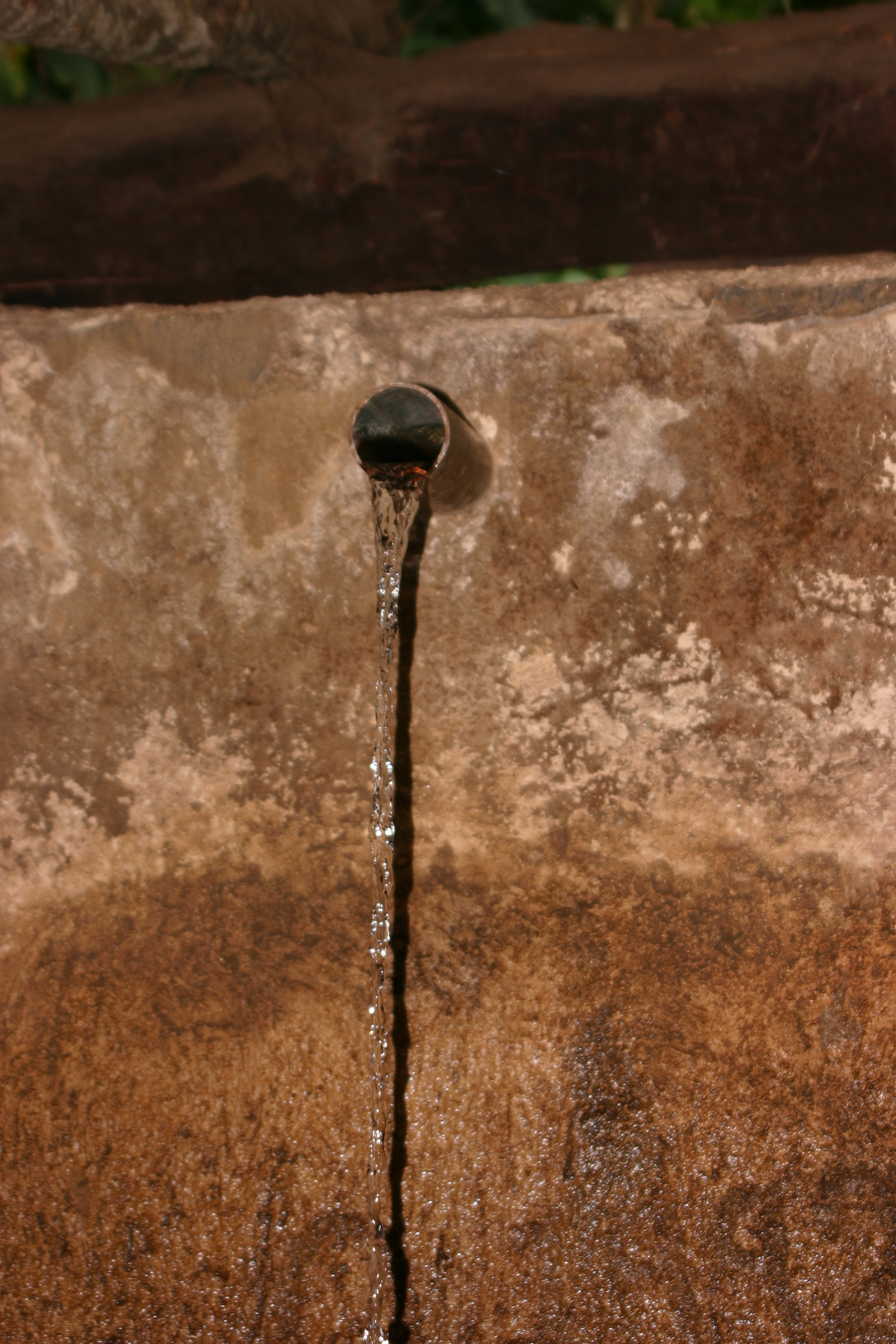
Source of the Blue Nile (1)
The springs emerged from a reedy marsh bound by a rock-and-wood fence and funneled through a rusted half-inch-in-diameter metal pipe into a little stone house. From there, it trickled into a baptismal pool. . . . It was hard to fathom that the water from this chipper rivulet had carved one of the deepest canyons in the world not far downstream, and that it was responsible for life and civilization in Egypt, so far away. [pp. 65, 67]

Source of the Blue Nile (2)
The source of the Blue Nile, or Gilgel Abay, as it is known to locals, is a muddy stream. This photo is taken a few feet from the source, at the Springs of Gish Abay at Sakala, Ethiopia. The Gilgel Abay drops 3,300 feet in 102 miles, flowing through lush green valleys and steep cedar-lined gorges before reaching Lake Tana. [between pp. 214-15]

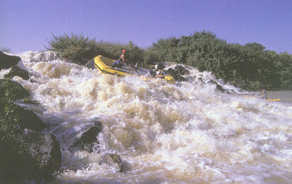
The Gauntlet
The entire Blue Nile squeezes into a crack in the earth less than ten feet wide. The river was so narrow here that the rafts would not fit through the canyon and had to be “ghost-boated,” or sent through without people aboard. [between pp. 214-15]

Pillars of the Grand Canyon of the Blue Nile
An expedition raft floats by the Pillars of the Grand Canyon of the Blue Nile in central Ethiopia. The Pillars are erosion remnants left from the carving of the canyon through thick basalts that cover much of the Ethiopian highlands. [between pp. 214-15]
Arafami Rapid
Scaturro guides one of the expedition rafts down a Class V-VI rapid that is part of the Arafami Falls on the upper Blue Nile, below Lake Tana. This was the first known descent of Arafami Rapid. [between pp. 214-15]

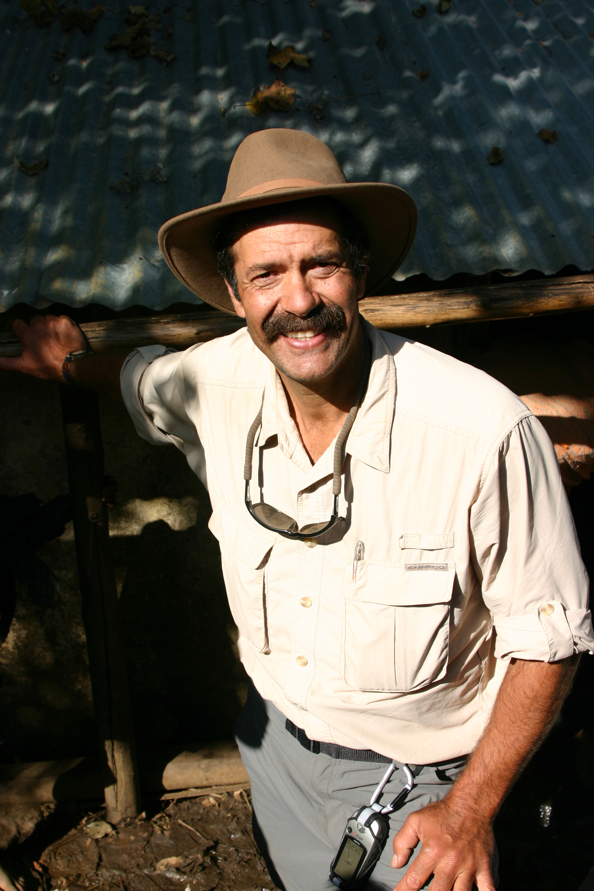
Protection
Baye Gebre Selassie (right) and Alemu Meharie, the two Ethiopian People's Revolutionary Democratic Front Special Forces soldiers who accompanied the expedition from Lake Tana to Bomaza, on the border with Sudan. There is no established authority along the Blue Nile corridor in the lowland western reaches of Ethiopia, and Baye and Alemu helped protect the expedition from shiftas and local militia. [between pp. 214-15]

Map-viewing
Pasquale Scaturro and Gordon Brown study a map of the Blue Nile in eastern Sudan. Very few maps of the Nile were available, and the expedition had to rely on large-scale maps with little usable detail. [between pp. 214-15]