
You are here
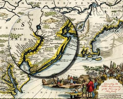
Nova Caesarea A Cartographic Record of the Garden State, 1666-1888
on display in the Main Gallery
08/16/2014 - 12:30pm to 01/25/2015 - 12:30pm
Commemorating the 350th anniversary of the naming of New Jersey, this exhibition introduces viewers to the maps that charted the state's development-from unexplored colonial territory to the first scientifically-surveyed state in the Union. Coastal charts, manuscript road maps, and early state maps provide a historical background to the major focus of the exhibition: the state's first wall maps and county atlases. The large scale of these maps allowed mapmakers to include the names/locations of nineteenth-century merchants and farmers, hence personalizing local history.