New Jersey Counties: First Wall Maps and Atlases
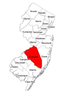
Burlington County
| County Data | |
| Founded: 1694 |
|
| Total Area: 820 square miles—the only county that bridges the width of the state, from the Delaware River to the Atlantic Ocean | |
| Population: 49,730 (1860); 448,734 (2010) | |
| County Seat: Mount Holly | |
| Largest City: Evesham Township |
1849: County Wall Map
![J. W. Otley and R. Whiteford. "Map of Burlington County Mostly from Original Surveys" (Philadelphia: Smith & Wistar, 1849) [Library of Congress]. Wall map, with ornamental border and added outline color, 83 × 163 cm. Scale: approx. 0.8 mile to 1 inch.](https://libimages.princeton.edu/loris2/exhibits%2Fnj-historic-maps%2Fburlington%2F1849-burlington-county-wall-map.jp2/full/!750,750/0/default.jpg)
First wall map of Burlington County. It includes separately-bordered maps of Burlington and Mount Holly. The county stretches horizontally from the Delaware River on the left to the Atlantic Ocean on the right. The fourteen townships—Burlington, Chester, Chesterfield, Egg Harbour (later, Little Egg Harbor), Evesham, Hanover, Mansfield, Medford, Northampton, Pemberton, Southampton, Springfield, Washington, Willingborough—are edged in blue, yellow, orange, pink, or green, but the rest of the map is uncolored. Names of landowners are located, but the region grows very sparse towards the ocean, as the sandy coastal plain is much less fertile. Large sections are covered with tree symbols denoting portions of the Pine Barrens, which extends across several counties of southern New Jersey.1 A historical note and engravings of City Hall in Burlington and the county buildings in Mount Holly complete the main features of the map.

The names of the larger towns arch in capital letters. A vast number of creeks, streams, and rivers traverse the coastal area. In Washington Township, a dotted line identifies geological regions of "Middle Secondary Red Sand." Several sites bear special mention. "Bonaparte's Place," shown on the bluff above Crosswicks Creek in Bordentown, was the site of the home of Joseph Bonaparte, Napoleon's brother, after his family's banishment from France in 1816. At the center of the map lies Apple Pie Hill, which is the highest point (179 feet) in the Pine Barrens.
Batsto, shown just above the "T" in "Atlantic Ocean," was rich in bog ore, and its iron works supplied the Continental Army with much-needed implements during the American Revolution. Since purchasing the buildings in the 1950s, the state has turned the whole village into a historic site.
1876: County Atlas
![James D. Scott. Combination Atlas Map of Burlington County, New Jersey: Compiled, Drawn and Published from Personal Examinations and Surveys (Philadelphia: J. D. Scott, 1876) [Historic Maps Collection]. 88 pp., including illustrations and maps.](https://libimages.princeton.edu/loris2/exhibits%2Fnj-historic-maps%2Fburlington%2F1876-titlepage.jp2/full/!320,320/0/default.jpg)

First atlas of Burlington County. The volume contains a state map of New Jersey; a map of the United States, plus geological and climatological maps of the nation; population statistics of the country from the 1860 and 1870 censuses (and for Canada from its 1871 census); and agricultural statistics for each state from the 1870 census. Other front matter includes a history of Burlington County and its townships, and a chronological list of the state governors. The heart of the volume consists of twenty-one township maps, thirty city/borough/village plans, and more than fifty lithographic views of residences and businesses. There are no maps for the extremely rural townships of Washington, Randolph, and Bass River. The very small Northampton Township has become absorbed by the town and suburbs of Mount Holly and is presented in a city map. Of interest at the back is a four-page directory of the subscribers to the atlas, providing each one's name, date of settlement, post office address, and occupation.
At this period in its history, Burlington County contained twenty-five townships, colored pink, yellow, green, or orange: Bass River, Beverly, Bordentown, Burlington, Chester, Chesterfield, Cinnaminson, Evesham, Florence, Little Egg Harbor, Lumberton, Mansfield, Medford, Mount Laurel, New Hanover, Northampton, Pemberton, Randolph, Shamong, Southampton, Springfield, Washington, Westhampton, Willingborough, and Woodland. The remnants of Northampton became Mount Holly Township in 1931. The Delaware River is shown at the top, the Atlantic Ocean at the bottom. According to the atlas's historical text, there were 130 miles of active railroad operations in the county and 2024 farms.
Indian Mills (Shamong Township) is named for mills run by the Brotherton people, Lenape Indians who had converted to Christianity after being re-located here on the Brotherton Indian Reservation. This was the state's first and only Indian reservation. It consisted of more than three thousand acres purchased by colonial commissioners as part of a larger agreement, called the Treaty of Easton, reached by the British with Indian tribes in Easton, Pennsylvania, in 1758. By 1802, the remaining Indians on the reservation had sold their land and removed to upstate New York.
!["Map of the Indian Lands at Edgepillock, alias Brotherton." Printed map, 25 × 28 cm, on larger sheet. From Major E. M. Woodward and John F. Hagemean's History of Burlington and Mercer Counties, New Jersey, with Biographical Sketches of Many of Their Pioneers and Prominent Men (Philadelphia: Everts & Peck, 1883) [General Collection].](https://libimages.princeton.edu/loris2/exhibits%2Fnj-historic-maps%2Fburlington%2F1883-indian-reservation-lands.jp2/full/!750,750/0/default.jpg)
◊ ◊ ◊
!["Little Egg Harbor [Township]." Lithograph map, with added color, 38 × 30.5 cm. Scale: 1 mile to 1 inch. The sheet also contains town plans of Herman City and Green Bank (Washington Township) and Lower Bank (Randolph Township).](https://libimages.princeton.edu/loris2/exhibits%2Fnj-historic-maps%2Fburlington%2F1876-little-egg-harbor-map.jp2/full/!350,350/0/default.jpg)
1834: Egg Harbour, Little, t-ship, Burlington co.. . . The northern part of the township, called the Plains, is of the former, covered with low pines and scrub oaks, forming an excellent covert for deer and grouse, which find abundant food in the mast produced by the latter. The southern part of the t-ship is sandy, covered with forest. It is drained chiefly by branches of Little Egg Harbour river, of which Bass river is here the chief. Tuckerton, upon Shorl's mill branch, is the post-town. Population in 1830, 1490. In 1832, the t-ship contained 150 house-holders, whose ratables did not exceed $30; 347 taxables, 51 single men, 6 stores, 4 saw mills, 3 grist mills, 1 two horse stage, 7 dearborns, 36 covered wagons, 10 gigs and sulkies, 640 neat cattle, 170 horses and mules; and it paid state tax, $127.48; county tax, $444; road tax, $300 [Gordon, p. 135].
This township became part of Ocean County in 1891.
◊ ◊ ◊

1834: Mount Holly, p-t., Northampton t-ship, and seat of justice of Burlington co., on the road from Camden to Freehold, and at the head of tide and navigation, on the north branch of the Rancocus creek, . . . has its present name from a mount of sand and sandstone near it, and some holly trees about its base. It was formerly called Bridgetown; and this name was recognized in a charter for a library company here, so early as 1765. At the period of the revolutionary war, the town contained 200 dwellings, and at present, 1833, has not more than 230; many of which are good brick buildings, erected on 7 streets. It contains a court-house of brick, about 40 by 60 ft., two stories high, with cupola and bell; a stone prison, 1 Episcopal, 1 Methodist, 1 Baptist churches, and 2 Quaker meetinghouses; 1 boarding school for young ladies, 4 day schools, 5 taverns, 8 stores, 1 grist mill, 1 saw mill, 1 fulling mill, woolen factory, plaster mill, and paper mill, of the latest and most improved construction, where paper of fine quality is made by machinery, and from 40 to 50 hands are employed—10 reams of paper may be manufactured by this mill yearly. The country around is flat; soil, sandy loam, generally of good quality, well cultivated, and worth from 40 to 120 dollars the acre, in extensive farms; corn, rye, and oats, are the chief products. A bank was established here in 1816, with authority to possess capital to the amount of $200,000; of which $100,000 only have been paid in. There run from the village, 2 stages twice a day to Burlington, 1 to Camden, 1 to Trenton, 1 to Pemberton, 1 to Vincenttown, 1 to New Egypt; and 2 to Manahocking, tri-weekly. There are 2 newspapers printed here, weekly; viz, the Herald, and New Jersey Mail [Gordon, p. 187].

◊ ◊ ◊

◊ ◊ ◊