
New Jersey Counties: First Wall Maps and Atlases
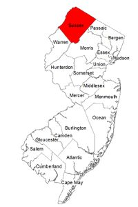
Sussex County
| County Data | |
| Founded: 1753, from Morris County |
|
| Total Area: 536 square miles | |
| Population: 23,846 (1860); 149,265 (2010) | |
| County Seat: Newton | |
| Largest City: Vernon Township |
1860: County Wall Map
![Griffith Morgan Hopkins, Jr. "Map of Sussex Co. New Jersey: From Actual Surveys & Records" (Philadelphia: Carlos Allen, 1860) [North Jersey History Center]. Wall map, with ornamental border and added color, 126.7 × 118.3 cm. Scale: 0.67 mile to 1 inch. "Founded on the State Geological Survey." [Used with permission of the North Jersey History Center, Morristown and Morris Township Library, Morristown, New Jersey.] (No county atlas was published.)](https://libimages.princeton.edu/loris2/exhibits%2Fnj-historic-maps%2Fsussex%2F1860-sussex-county-wall-map.jp2/full/!750,750/0/default.jpg)
First wall map of Sussex County. There are thirteen townships, very faintly colored in yellow, pink, orange, or blue: Byram, Frankford, Green, Hardyston, Lafayette, Montague, Newton, Sandyston, Sparta, Stillwater, Vernon, Wallpack, and Wantage. In addition, plans for twenty-one villages and towns circle the county map (_clockwise from top left_): Newton, Hamburg, Peter's Valley, Swartswood, Coleville, Mount Salem, Beemerville, Milford (Pa.), Deckertown, Vernon, Sparta, Stanhope, Franklin Furnace, Greensville, Lafayette, Andover, Stillwater, Huntsville, Balesville, Flatbrookville, and Branchville. A single engraving (_bottom right_) presents the stately residence of Robert Hamilton of Newton, a prominent lawyer at the time, who was a delegate to the 1860 Democratic National Convention. He later became a congressman and banker. Distances between thirty-one towns and villages are provided in the adjacent table. At the top of the map, longitude is measured east from the Capitol (Washington, D.C.); at the bottom, west from Greenwich, England.
A unique feature of this map's key is the category of "Tenant Houses." (Probably this status became known at tax collection time.) The names of the heads of these households appear underlined on the map, interspersed with the names of landowners. Below the key, a table of statistics provides a useful educational snapshot of the county in 1859. For each township, it lists size (in acres), total value of real and personal property, polls (adult males), amount of county tax paid, number of children between five and eighteen years of age, number of children who attended school, school money raised by tax, school money received from the state, total school money, and number of school districts. This data suggests that 82% of school-age children went to school, at a cost of $2.40 per pupil, and that the state paid for 37% of the cost of educating them.
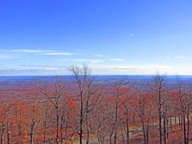
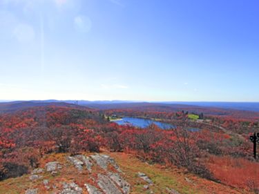
Running diagonally across the western part of the map are the Blue Mountains (today's Kittatinny Mountains), a ridge forming the eastern border for Montague, Sandyston, and Wallpack Townships. Above Lake Mascia (= Lake Marcia) in Montague Township, a simple point labeled "High" marks the state's highest elevation (1,803 feet).

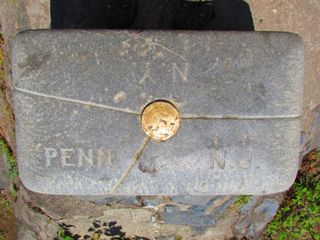
The state's most northern point is also the top corner of Montague Township where Pennsylvania, New York, and New Jersey meet, shown as the junction of the Neversink Creek and the Delaware River on the map.

Beneath Newton, and adjacent to railroad tracks, is a circle labeled "Sus. Co. Fair." Established in 1856, the Sussex County Agricultural Society incorporated two years later.1 That same year, the Sussex County Agricultural Fair, Cattle Show and Horse Exhibition was held on these Newton grounds. A contemporary newspaper article described them as "twenty-two acres of land, enclosed with a fence eight feet high, and containing a half mile circular track for the exhibition of horses, cattle and other stock."2 (The New Jersey State Fair is now held annually in August at the Sussex County Fairgrounds in Augusta.) The only railroad in the county at the time was the Sussex Railroad, shown in the lower middle of the map, which replaced the narrow gauge Sussex Mine Railroad in 1853. It later became a branch of the Delaware, Lackawanna and Western Railroad, providing service through 1966. Subsequently, the tracks were removed, making way for today's Sussex Branch Trail.
1872: County Map
![F. W. Beers. 'Topographical Map of Sussex Co., New Jersey.'' From Beers's "State Atlas of New Jersey: Based on State Geological Survey and from Additional Surveys by and under the Direction of F. W. Beers" (New York: Beers, Comstock & Cline, 1872) [Historic Maps Collection]. Lithograph map, with added color, 34.7 × 54.5 cm. Scale: 2 miles to 1 inch.](https://libimages.princeton.edu/loris2/exhibits%2Fnj-historic-maps%2Fsussex%2F1872-sussex-county-map.jp2/full/!350,350/0/default.jpg)
This map of Sussex County is from the state's first atlas. The county now consists of fourteen townships, identified in pink, yellow, blue, or orange: Andover, Byram, Frankford, Green, Hampton, Hardiston, Lafayette, Montague, Sandiston, Sparta, Stillwater, Vernon, Walpack, and Wantage. The incorporated town of Newton (1864) is shown in green.
1834: Newton. . . . The town lies upon the slope of a gentle hill, of mingled slate and limestone, at whose foot a spring sends forth the first waters of the Paulinskill, the chief river of the county. . . . There are several streets, and a large common or public lot, fronts the court-house and prison, and on which the public offices are erected. It contains about 130 dwellings, and 900 inhabitants, 4 taverns, 8 extensive stores, 2 printing offices, at each of which a weekly journal is published . . . ; a very large and commodious Presbyterian church, an Episcopal church, with a valuable glebe farm of 200 acres near the town; and a Methodist church; 9 seminaries, in which the classics are taught . . . ; 6 common schools, 3 Sunday schools, a public library, a lyceum for the promotion of the study of letters and science; a bank with a capital of $100,000, established in a handsome building, specially erected for it. The court-house is a low and ancient looking stone building, finished in 1765, having the prison in the basement story. There are in the town 4 practising attorneys, 4 physicians, and 2 resident clergymen. Some of the dwellings are very neat: the place has an air of business, and there is in fact a very considerable trade carried on with the surrounding country. In healthiness of situation, by the report of its inhabitants, it cannot be excelled [Gordon, p. 199].
Already, railroad lines and their spurs service many of the townships. The Ogden Mine Railroad was built in 1866 to transport iron ore from mines in Sparta Township to Lake Hopatcong, where, transferred to barges, the raw material could journey on the Morris Canal to smelters. It closed during ice season.
Shown stretching across Sandiston and Montague Townships, the "Rutherford Tract" identifies land owned by John Rutherfurd of Tranquility. He was the largest landowner in North Jersey during the nineteenth century. His grandfather was James Alexander, surveyor general of both the East and West Jersey proprietors during the colonial period.3 (See also the 1784 state map in the Historical Background section.)