
New Jersey Counties: First Wall Maps and Atlases
Salem County
| County Data | |
| Founded: 1694 |

|
| Total Area: 372 square miles | |
| Population: 22,458 (1860); 66,083 (2010) | |
| County Seat: Salem | |
| Largest City: Pennsville |
1849: County Wall Map
![Alexander C. Stansbie, James Keily, and Samuel M. Rea. 'A Map of the Counties of Salem and Gloucester New Jersey. From Original Surveys' (Philadelphia: Smith & Wistar, 1849) [Library of Congress]. Wall map, with ornamental border and added color, 94 × 133 cm. Scale: approx. 0.8 mile to 1 inch.](https://libimages.princeton.edu/loris2/exhibits%2Fnj-historic-maps%2Fsalem%2F1849-salem-county-wall-map.jp2/full/!750,750/0/default.jpg)
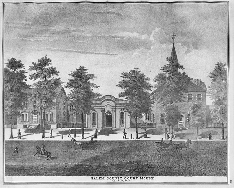
First wall map of Salem County. A yellow line marks its border with Gloucester County, much of which follows Old Man's Creek (called Oldmans Creek today). A large inset plan of Salem City occupies the map's upper right corner. Named with large capital bold letters, ten townships are shown, tinted green, yellow, orange, blue, or pink: Elsinborough, Lower Alloways Creek, Lower Penns Neck, Mannington, Pilesgrove, Pittgrove, Salem, Upper Alloways Creek, Upper Penns Neck, and Upper Pittgrove. Smaller bold letters identify the major communities; many of the roads carry distance information. At the bottom right, a table provides statistics (1847) for each township: size (in acres), number of taxables and householders, and total county tax paid. (Each township supports about 350 landowners; the average household paid about five dollars in county tax that year.) A small engraving of the county buildings in Salem sits in the bottom right corner.
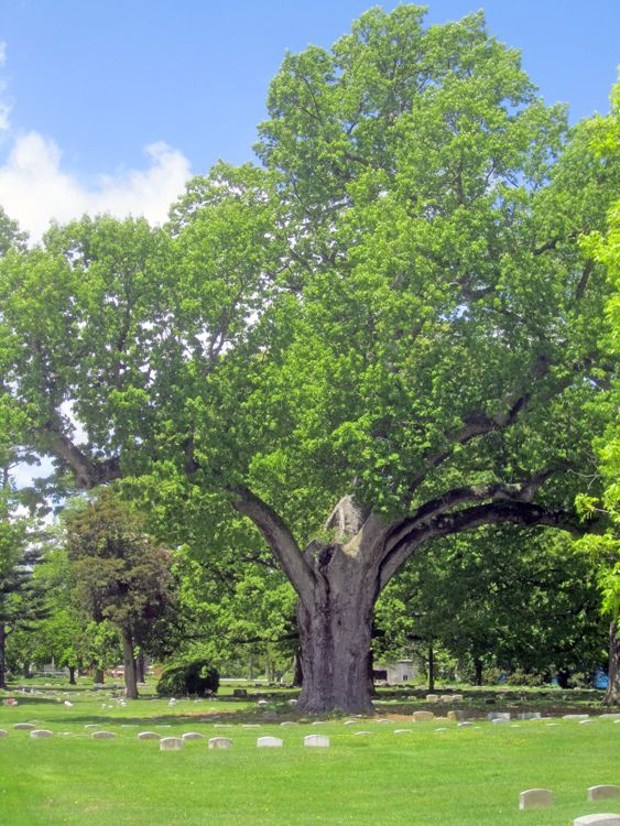
There are no railroads in the county, but a line from Penns Grove on the Delaware River to Woodstown (Pilesgrove Township) is shown proposed. (It was not built.) In the Salem city map, there is a small illustration of a tree on Quaker property. This is the great Salem Oak Tree, one of the most famous trees in America. Its foliage covers a quarter of an acre.
1876: County Atlas
![Everts & Stewart. Combination Atlas Map of Salem & Gloucester Counties, New Jersey: Compiled, Drawn and Published from Personal Examinations and Surveys (Philadelphia: Everts & Stewart, 1876) [courtesy of Joseph J. Felcone]. 86 pp., including maps. (shared with Gloucester County)](https://libimages.princeton.edu/loris2/exhibits%2Fnj-historic-maps%2Fsalem%2F1876-salem-county-map.jp2/full/!350,350/0/default.jpg)
First atlas of Salem County. (See entry under Gloucester County for a fuller description of the contents of the atlas.) The Salem section of the atlas contains ten township maps, sixteen town and village maps, and forty-seven lithographic views. No scales given.
For the title page, see the image in the Gloucester County section.
The map still shows ten townships, colored pink, yellow, orange, or green: Elsinborough, Lower Alloways Creek, Lower Pennsneck, Mannington, Pilesgrove, Pittsgrove, Quinton, Upper Alloways Creek, Upper Pennsneck, and Upper Pittsgrove. But, in 1858, Salem City absorbed the former Salem Township, and part of Upper Alloways Creek Township gave birth to Quinton Township in 1873.
◊ ◊ ◊
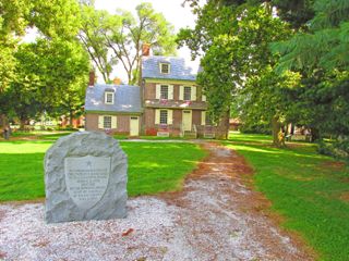
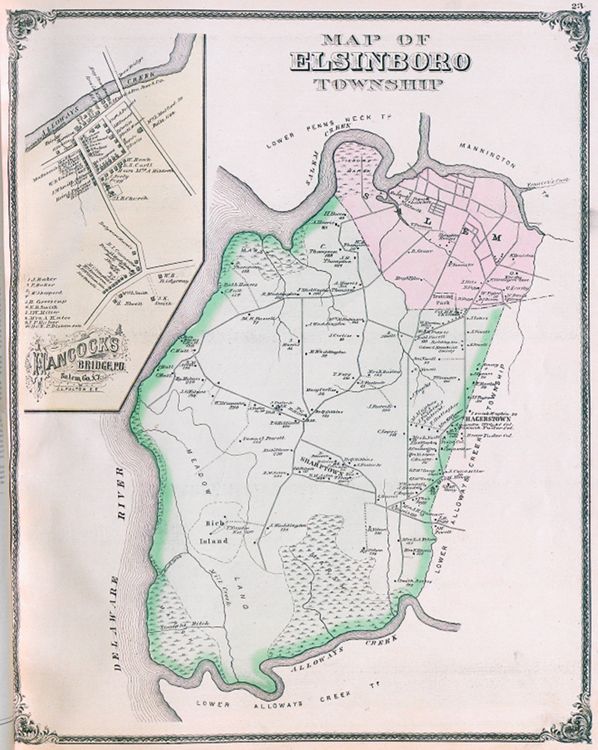
The Hancock's Bridge Massacre took place in the early morning hours of March 21, 1778, when British troops surprised American militia sleeping in the Hancock House by Alloway Creek (shown on the map as "Mrs. L. Milford built 1734"). These troops had been in the area foraging for food and supplies about a month after American General Anthony Wayne had made his secret cattle drive—the first one in the United States—from the county to feed the starving soldiers at Valley Forge, Pennsylvania.
◊ ◊ ◊
The westernmost point of New Jersey:

Actually, this is Delaware! The anomaly stems from the 1682 grant by the Duke of York to William Penn, allowing him to extend his Delaware colony by a twelve-mile radius from the top of the courthouse cupola in New Castle. Because the arc of this radius would fall over part of New Jersey, a compromise was reached that gave Delaware sovereignty for those miles across the Delaware River up to the low-tide mark along its eastern shore. During the past century, Delaware River dredging and subsequent dumping activities of the U.S. Army Corps of Engineers has resulted in an expansion of the Pennsville Township (N.J.) peninsula into the river—literally, an expansion of Delaware's territory. As recently as 2008, the U.S. Supreme Court upheld Delaware's jurisdiction over this man-made land. (For the same reason, part of the Artificial Island where the Salem Nuclear Power Plant is located also belongs to Delaware.)

The map on the left shows the area affected along the eastern shoreline of the Delaware River.1 Below, a dotted line indicates the boundary between the two states and the extensive territory Delaware now commands on the New Jersey side of the Delaware River.
![Delaware/New Jersey border [Map data: Google Maps, 2013]](https://libimages.princeton.edu/loris2/exhibits%2Fnj-historic-maps%2Fsalem%2Fpennsville-township--google-map.jp2/full/!750,750/0/default.jpg)