
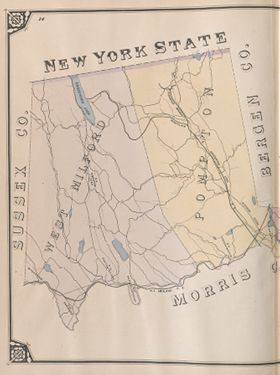
New Jersey Counties: First Wall Maps and Atlases
Passaic County
| County Data | |
| Founded: 1837, from Bergen and Essex counties |

|
| Total Area: 197 square miles | |
| Population: 29,013 (1860); 501,226 (2010) | |
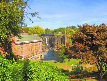
| County Seat: Paterson | |
| Largest City: Paterson |
1861: County Wall Map
![Griffith Morgan Hopkins, Jr. "Map of the Counties of Bergen and Passaic, New Jersey: From Actual Surveys" (Philadelphia: G. H. Corey, Publisher, 1861) [Library of Congress]. Wall map, with ornamental border and added color, 139 × 113 cm. Scale: 1 mile to 1.5 inches.](https://libimages.princeton.edu/loris2/exhibits%2Fnj-historic-maps%2Fpassaic%2F1861-passaic-county-wall-map.jp2/full/!750,750/0/default.jpg)
First wall map of Passaic County. A thick pink line marks its border with Bergen County. Pequanock River forms much of its western limits; and the Passaic River, the southern. Five townships, alternately colored pink, green, yellow, orange, or blue, are identified: Acquackanonck, Manchester, Pompton, Wayne, and West Milford. (Acquackanonck became the city of Clifton in 1917.) The large incorporated city of Paterson (1851) is pink. Circling the map are sixteen additional town plans, including a very detailed one (at a scale of 600 feet to 1 inch) for the largest, Paterson, shown at the top right. (See the listing of these town plans in the description of the map in the Bergen County section.) In addition, business directories for Paterson, Carlstadt, and Passaic are provided. Landowners' names populate the map.
Paterson dominates Manchester Township. In the inset map of the city, "Society's Island S.U.M." labels the island next to the bridge that spans the Passaic Falls. Championed by Alexander Hamilton, the first American secretary of the Treasury, the Society for the Establishment of Useful Manufactures was created in 1791 to spark industrial growth around a planned manufacturing town. Having visited the area, Hamilton saw the potential of the Passaic Falls for supplying the needed power: the city of Paterson was born. More than a dozen mills had begun operation there by 1815, making Paterson a major engine of America's young industrial revolution.
The Morris Canal is shown winding through Wayne and Acquackanonck townships. Along the Passaic River near the city of Passaic, in lower Acquackanonck, the Dundee Manufacturing Company occupies a large area. It had built a dam (ca. 1833) and a canal (1858–1861) to supply hydropower to manufacturers in the area. Later, it became a water power and land development company.
1877: County Atlas
![E. B. Hyde & Co. Atlas of Passaic County, New-Jersey: Topographical, Geological, Historical, Illustrated: From Actual Surveys of Each Township and Village (New York: E. B. Hyde & Co., 1877) [courtesy of Joseph J. Felcone]. 112 pp., including maps.](https://libimages.princeton.edu/loris2/exhibits%2Fnj-historic-maps%2Fpassaic%2F1877-county-atlas-title-page.jp2/full/!320,320/0/default.jpg)
First atlas of Passaic County. The volume contains maps of the United States and New Jersey, two maps of Passaic County (one is geological), two city index maps (Passaic and Paterson), six township maps, eight village plans, fourteen lithographic views, a historical sketch of Passaic County, and a table of distances between villages. It concludes with a "Business Representation of Paterson and Passaic County," listing the patrons of the atlas.
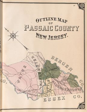
The map shows the county now with six townships—Acquackanonck, Little Falls, Manchester, Pompton, Wayne, West Milford—and two incorporated cities: Passaic (1873) and Paterson.
◊ ◊ ◊
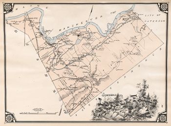
Dominating the map are the Passaic River and Morris Canal, which provide convenient water power and transportation opportunities for the area's mills and factories. A significant geological feature of the township is the Great Notch, shown at the lower middle section of the map. This is one of the few natural gaps in the curvilinear ridges of the Watchung Mountains. The numbers along the roads are the distances (in rods) between junctures and crossings.
◊ ◊ ◊

The map gives the size (in acres) of many of the landowners' estates. In its earlier days, the town supplied the Continental Army with cannon balls and grapeshot from its iron works; through the end of the nineteenth century, it boasted a steel manufacturing plant (among the buildings at the lower left).
The center of today's town of Pompton Lakes lies in the light green area adjacent to the Wynockie (Wanaque) River, where the main road, coming from the lower left community, bends and crosses the river. The latter is now the Hamburg Turnpike, and the large island in the middle of the river is Wilderness Island Park. The two parts of a lake shown at the bottom of the map form Pompton Lake. The unnamed road (in the map's pink area) heading along the shore of the lake is called Terhune Drive (Route 202), after Albert Payson Terhune, the famous writer of dog stories, such as Lad: A Dog.
1834: Pompton, p-t., . . . containing a tavern, grist mill, and 12 or 15 dwellings, and a Dutch Reformed church [Gordon, p. 219].
The mill and church are visible on the map.
Back to Top