
New Jersey Counties: First Wall Maps and Atlases
Warren County
| County Data | |
| Founded: 1824, from Sussex County |

|
| Total Area: 363 square miles | |
| Population: 28,433 (1860); 108,692 (2010) | |
| County Seat: Belvidere | |
| Largest City: Phillipsburg |
1852: County Wall Map
![D. McCarty. "Map of Warren County, New Jersey" (Philadelphia: Friend and Aub, 1852) [Library of Congress]. Wall map, with ornamental border and added color, 128 × 100 cm. Scale: 60 chains to 1 inch.](https://libimages.princeton.edu/loris2/exhibits%2Fnj-historic-maps%2Fwarren%2Fwarren-lc.jp2/full/!750,750/0/default.jpg)
First wall map of Warren County. Orange, yellow, pink, green, or blue colors identify the incorporated town of Belvidere and fourteen townships: Blairstown, Franklin, Frelingh usen, Greenwich, Hardwick, Harmony, Hope, Independence, Knowlton, Mansfield, Oxford, Pahaquarry, Phillipsburg, and Washington. Drawing from the U.S. census of 1850, a data table at the top lists vital statistics for each of those districts: population and the number of churches, dwellings, farms, sawmills, horses, and cows. (The "Description" on the right proclaims this to be "one of the best agricultural Districts in the State.") In addition, town plans for Hope, Hackettstown, and Belvidere grace the sides of the central map, and an inset at the bottom enlarges the region between the towns of Phillipsburg and Lopatcong. Engravings of the state capitol in Trenton and the county courthouse in Belvidere, as well as a view of the Delaware Water Gap, complete the visual features of the map.
The names of the county's major communities arch in bold capital letters. The homes of numerous pre-Civil War landowners dot the rural landscape. At the center of the map lies Oxford Furnace, named for the state's longest-operating (1741–1884), iron-smelting furnace. It was the first in the state to be built near its raw material. It was also the first in the country (1835) to utilize "hot-blast" technology that reduced fuel consumption and production time by blowing preheated air into the furnace chamber. Orange "O.F.L." or "Oxford Furnace Lands" identify areas of iron ore, wood, limestone, and water resources utilized by the furnace.
To the north in Hope Township, the large topographical feature of Jenny Jump Mountain stands out, adjacent to Oxford Furnace land. There are several versions of a colonial-era story that purportedly accounts for its name—relating how a young girl jumped to her death there when she was chased or frightened by an Indian. Much of the area is now a state park. Large Ice Age boulders abound as a result of the mountain ridge's proximity to the terminal moraine at its south; this marks the farthest advance of the most recent North American ice sheet, called the Wisconsin glaciation, of 21,000 years ago.
More than usual in these large cartographic productions, credit is given on the map where it is due: the engravings are signed, the ten surveyors responsible for the map's accuracy are named, and the town plans have by-lines. Charles P. Tholey (1832–1895), who drew the Delaware Water Gap view, belonged to a family of German lithographers and artists that were active in Philadelphia during the last half of the nineteenth century.
1860: Township Wall Map
![1860: Township Wall Map. Matthew Hughes. "Farm Map of Greenwich Township, Warren Co., N.J." ([Philadelphia?]: Matthew Hughes, 1860) [Historic Maps Collection]. Wall map, with added color, 129 × 87 cm. Scale: 1,000 feet to 1 inch. One of two known copies.](https://libimages.princeton.edu/loris2/exhibits%2Fnj-historic-maps%2Fwarren%2F1860-greenwich-township-wall-map.jp2/full/!350,350/0/default.jpg)
First wall map of Greenwich Township. It is surrounded by fourteen views of local residences and businesses, and a list of sixty-one subscribers. Colored pink, yellow, blue, orange, or green, the individual properties are identified by owner and often in size (acres). Uppercase boldface letters name the villages, but roads and streams are unnamed. Crossroads bear numbers in parentheses, which are used as keys in the map's adjacent table to indicate distances between the villages. The Delaware River forms the western border, the Musconetcong the southeastern. The largest topographical feature on the map is Pohatcong Mountain, which runs parallel to the Musconetcong River (called "Creek" here). The Central Railroad of New Jersey crosses the township and has one small depot stop.
1834: Greenwich, t-ship, Warren co., . . . . The turnpike road from Somerville runs N. W. and that from Schooley's mountain W. through the t-ship to Philipsburg, on the Delaware, opposite to Easton. Below that town the Morris canal commences, and runs across the t-ship. Taxables in 1832, 830; at that time the t-ship contained 266 householders, whose ratables did not exceed $30 in value; 9 stores, 17 run of stones for grinding grain, 1 fishery, 2 carding machines, 1 cotton factory, 3 oil mills, 1 fulling mill, 3 distilleries, 930 horses and mules, and 1265 neat cattle over 3 years of age. Although this t-ship be very mountainous, it is one of the most productive, not only of the county, but of the state. Whilst the mountains assume a granitic character, the valleys are every where underlaid with limestone, and their soils fertile. The valleys of the Musconetcong, the Pohatcong, and Lopatcong, and even the small vales through which their tributaries wander, are highly cultivated and improved, and there are farmers who send to market from one thousand to three thousand bushels of wheat annually, beside other agricultural productions [Gordon, p. 152].
1874: County Atlas
![Title page. F. W. Beers. County Atlas of Warren, New Jersey: From Actual Surveys (New York: F. W. Beers & Co. . . . , 1874) [Historic Maps Collection]. 92 pp., including maps.](https://libimages.princeton.edu/loris2/exhibits%2Fnj-historic-maps%2Fwarren%2F1874-title-page.jp2/full/!320,320/0/default.jpg)

First atlas of Warren County. Included are maps of the United States, New Jersey, the county, fifteen townships, and thirty-nine towns and villages. The volume begins with a table of Warren County distances and tables of the 1870 state census, alphabetically arranged by county, showing totals for white and black ("colored") populations. The concluding pages are devoted to "Warren County Business Notices" for each township and the large towns, roughly in north to south order.
Now totaling fifteen, the townships are colored orange, yellow, blue, or pink: Allamuchy, Blairstown, Franklin, Frelinghuysen, Greenwich, Hardwick, Harmony, Hope, Independence, Knowlton, Lopatcong, Mansfield, Oxford, Pahaquarry, and Washington. The municipalities of Belvidere (1845), Hackettstown (1853), Washington (1868), and Phillipsburg (1861) are green. Major towns and geographic features are printed in bold letters. The Morris Canal sweeps across the county in a northeasterly direction from its start in Phillipsburg on the Delaware River. Paulin's Kill (also known as Paulinskill River), a major tributary of the Delaware, boldly crosses several northern townships. A number of iron ore sites are identified in Hope and Oxford townships. Note that a few new railroad lines are proposed in those areas. Forming the entire southern border of Pahaquarry Township, the former Blue Mountains are now the Kittatinny Mountains.
◊ ◊ ◊
!["Independence [Township]." Lithograph map, with added color, 35.7 × 27.6 cm. Scale: 200 rods to 1 inch. Includes inset plans of Danville and Vienna (both at the scale of 30 rods to 1 inch).](https://libimages.princeton.edu/loris2/exhibits%2Fnj-historic-maps%2Fwarren%2F1874-independence-township-map.jp2/full/!350,350/0/default.jpg)
School districts are colored yellow, pink, blue, or green; dark green distinguishes the area of Hackettstown, incorporated in 1853. The Musconetcong River and the Morris Canal run parallel in the southeast section of the township, with the Delaware, Lackawanna and Western Railroad tracking between them. Major towns are printed in bold capital letters. Above and to the left of "Whitehall," Mastodon Pond locates the site of an 1844 discovery of a complete mastodon skeleton that was subsequently sold to Harvard University for three thousand dollars. The financial circumstances figured in Boston's gruesome 1849 murder of George Parkman by John Webster that gained worldwide notoriety. Another area around Hackettstown notes where "large quantities of mammoth bones" were found. The potential of the rich, boggy Great Meadows was first realized in the 1760s, but draining efforts—by deepening and widening Pequest River—did not succeed until the late 1800s. Trimmers Island and Youngs Island were the largest upland farming areas in the Meadows, reached by private flood-prone roads.
1834: Independence t-ship, Warren co. . . . Centrally distant N. E. from Belvidere, the county town, 14 miles; greatest length 9 miles N. and S.; breadth E. and W. 8½; area, 29,440 acres; surface hilly on the E. and W., but a valley runs centrally through the t-ship which is drained by the Pequest creek, and on which there is a larger body of meadow land. . . . There were in the t-ship in 1839, 2126 inhabitants; in 1832, 429 taxables, 10,000 acres of improved land, 414 horses and mules, and 1066 neat cattle, over 3 years of age; 146 householders, whose ratables did not exceed $30; 8 stores, 11 pairs of stones for grinding grain, 6 saw mills, 21 tan vats, 4 distilleries; and it paid in t-ship taxes for the poor and roads, $900; and in county and state tax, $880.95. This ranks as among the most valuable precincts of the state. The valleys are of fertile limestone, and the hill sides have been subjected to cultivation to a very great extent. The ridges which cross the t-ship from the S.W. to the N.E. are metalliferous, and upon the "Jenny Jump," in the N.W. [top left on map], a gold mine is said to exist. Preparations have ostensibly been made for smelting the ore, but "wise ones" have little confidence in the undertaking, and consider the mineral discovered, if any, to be pyrites or fool's gold [Gordon, pp. 161–162].
◊ ◊ ◊
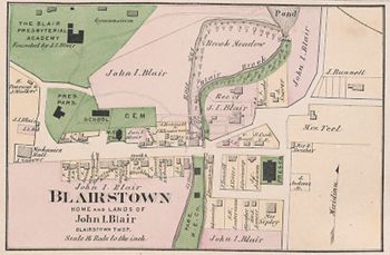
Gravel Hill, formerly Buff's Bridge, became Blairstown in 1839 in honor of John Insley Blair (1802–1899), its entrepreneur par excellence. During his long life, Blair became president of sixteen railroads and owner of the most railroad mileage in the world. He managed his empire from Blairstown and from a private rail car he used to tour his companies. His son-in-law was Charles Scribner (1821–1871), founder of the publishing house of Charles Scribner's Sons.
1834: Gravel Hill, village and p-t, of Knowlton t-ship, Warren co., in the valley of the Paulinskill, near the east line of the t-ship, distant by post road from W. C. 243 miles, from Trenton 85, and from Belvidere N. E. 15 miles; contains a large grist mill, tavern, store, tannery, and 6 or 8 dwellings; soil limestone [Gordon, p. 150].
On the map, educational and religious properties are colored green; Blair's properties are pink.
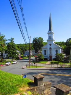
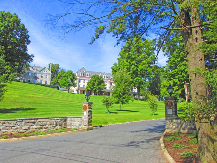
Agreeable to notice, publicly given, the citizens of Blairstown and vicinity convened in the Presbyterian church, in Blairstown, this day [April 6, 1848], for the purpose of selecting a site for an Academy, and appointing a committee whose business it shall be to superintend its erection. The meeting was called to order by John I. Blair, Esq., and organized by appointing John Messler, Chairman, and Isaiah W. Condict, Secretary. The hilltop west of the Methodist Church and south of the burying ground in Blairstown was selected for the site of the building, and was offered gratuitously for the purpose by the possessor John I. Blair, Esq.1
Today, Blair Academy is a coeducational college preparatory boarding school of 450 students. It occupies 425 hilltop acres in Blairstown.