
Nova Cæsarea: A Cartographic Record of the Garden State, 1666-1888
About This Site
They say you can’t go home again. But with maps (and illustrations and photographs) you can learn how much of the past resides in the present. They keep history palpable. The 350th anniversary (1664–2014) of the naming of New Jersey provides one of those Janus-faced opportunities when looking back can take us forward, for the maps on this site both memorialize the past and orient the future. At their most useful, historic maps allow you to re-examine a place you thought you knew—New Jersey, for example.
This website has five main sections. First, it provides an overview of land surveying methods in the “Perspective” section, which describes the techniques used by colonial surveyors to create some of the first maps of the state territory.
The mapping begins with coastal charts, manuscript maps, and selected state maps from the seventeenth and eighteenth centuries that provide historical background to nineteenth-century cartographic development.
Significant state wall maps follow, leading the way to the first New Jersey state atlas (1872) and the state’s first topographical, or scientific, atlas (1888). In these maps, the state comes of age and shows itself to be an important agricultural and manufacturing region.
The major part of the website is devoted to the first wall maps and atlases of the state’s twenty-one counties, where nineteenth-century landowners/farmers receive prominent attention. This is an up-close and personal look at New Jersey from the ground level, at a time when communities were forming their public identities.
The final section covers the Jersey shore, from Sandy Hook to Cape May, during the grandeur of its Victorian Age.
◊ ◊ ◊
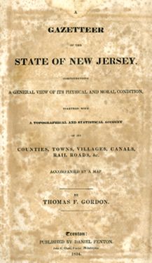
Supporting the maps are illustrations from the atlases and, where possible and appropriate, recent photographs of the same structures and areas for the purpose of historical contrast. An important New Jersey historical source has been utilized in the process: A Gazetteer of the State of New Jersey, the state’s first gazetteer, published in 1834. Its author, Thomas F. Gordon (1787–1860), should not be confused with the New Jersey wall map cartographer of the same name; this unrelated Gordon was a Pennsylvanian who compiled gazetteers of the three Middle Atlantic states.

Gordon’s notes on every village, hamlet, and creek provide interesting textual references to the visual features of the maps. They give a sense of the size and tenor of the communities in the early 1800s. Quotations from that work are dated 1834.
The “documentary” photographs were taken with a Canon PowerShot SX160 IS digital camera during sorties around the state last year. They are dated 2013 or 2014.
The maps were measured between the neat lines, vertically then horizontally. Because many of these maps are quite large and are presented in reduced format, their scales provide a means of comparison. The sources of the maps and atlases are given in brackets after their titles.
Back to Top