New Jersey Counties: First Wall Maps and Atlases
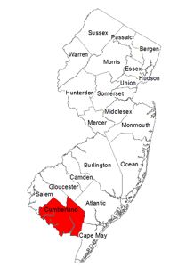
Cumberland County
| County Data | |
| Founded: 1748, from Salem County |
|
| Total Area: 678 square miles | |
| Population: 22,605 (1860); 156,898 (2010) | |
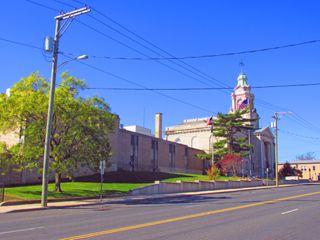
| County Seat: Bridgeton | |
| Largest City: Vineland |
1862: County Wall Map
![S. N. Beers, F. W. Beers, L. B. Lake, and C. S. Warner. "Map of Cumberland Co., New Jersey: Fom Actual Surveys" (Philadelphia: A. Pomeroy, 1862) [Library of Congress]. Wall map, with added outline color, 146 × 136 cm. Scale: 1 mile to 1.625 inches.](https://libimages.princeton.edu/loris2/exhibits%2Fnj-historic-maps%2Fcumberland%2F1862-cumberland-county-wall-map.jp2/full/!750,750/0/default.jpg)
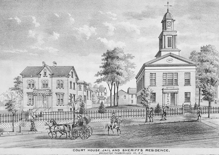
First wall map of Cumberland County. Yellow, green, blue, pink, and orange border colors identify ten townships: Bridgeton, Cohansey, Deerfield, Downe, Fairfield, Greenwich, Hopewell, Maurice River, Millville, and Stow Creek. (Cohansey only existed in the county from 1848 to 1865. Incorporated on March 1, 1865, Bridgeton City replaced both Cohansey and Bridgeton townships.) Around the sides of the map are eighteen insets of town plans (_in clockwise order from top left_): Port Elizabeth, Vineland, Dorchester, Greenwich, Newport, Heislerville, Roadstown, Millville (25 rods to 1 inch), Fairton, Maurice Town, Leesburg, Cedarville, Bricksboro, Dividing Creek, Shiloh, Marshallville, Bridgeton (22.5 rods to 1 inch), and Manamuskin Manor. Most of these include a business directory. Similar to the other county maps, numerous Civil War–era landowners are named and located. In addition, there are four engravings of buildings: the private home of Millville resident Furman L. Mulford (Millville's banker), Millville's public schoolhouse, and Bridgeton's courthouse and West Jersey Academy.

Significant wetlands follow the Delaware River along the county's southern border of the map. Much of Maurice River Township appears vacant and undisturbed, owing to the extensive forests of the Pine Barrens. Bear Swamp in Downe Township is notable today for its old-growth forests; it is home to the state's oldest continuously occupied Bald Eagle nest. A series of man-made dams—from earthen in the 1860s to cement in the 1980s—has turned Union Mill Pond in Millville Township into Union Lake, the largest in southern New Jersey, surrounded by one of the state's largest wildlife management areas.
1876: County Atlas
![D. J. Stewart. Combination Atlas Map of Cumberland County, New Jersey. Compiled, Drawn and Published from Personal Examinations and Surveys. (Philadelphia: D.J. Stewart, 1876) [Historic Maps Collection]. 45 pp., including maps.](https://libimages.princeton.edu/loris2/exhibits%2Fnj-historic-maps%2Fcumberland%2F1876-title-page.jp2/full/!320,320/0/default.jpg)

First atlas of Cumberland County. The volume contains a map of the United States, a state map of New Jersey, a map of Cumberland County, eleven township maps, and an additional twenty-two maps of cities, towns, and villages. More than forty lithographic views of residences, farms, businesses, and public buildings provide a graphic identity to the period. County officers and governors of New Jersey are listed, followed by a history of Cumberland County and historical sketches of townships. At the back of the volume is a business directory that provides, by township, the name, date of settlement in the county, nativity, occupation/business, and location of the atlas's patrons.
Townships, now numbering eleven, are colored green, yellow, pink, or orange: Bridgeton, Commercial, Deerfield, Downe, Fairfield, Greenwich, Hopewell, Landis, Maurice River, Millville, and Stow. (Commercial was incorporated in 1874 from parts of Downe Township.) The large numbers (such as "8," "25," "21") simply refer to the pages of the related, more detailed maps.
◊ ◊ ◊
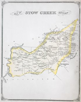
Stow Creek was one of the original six townships when the county was founded in 1748.
1834: Stow Creek t-ship . . . area, 10,240 acres; surface, partly level, partly rolling; soil, clay, loam, sand, and gravel. Population in 1830, 791. In 1832, the t-ship contained 170 taxables, 21 householders, whose ratables did not exceed $30; 4 grist mills, 1 saw mill, 198 horses and 557 cattle, above the age of 3 years, 1 store; and paid road tax, $200; state and county, $437.81. Newport creek forms the boundary between this and Greenwich t-ship [Gordon, p. 244].
◊ ◊ ◊
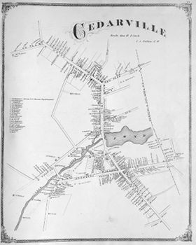
At the time of the map, the town boasted nine general stores, a hotel, a large town hall, and four churches (two Presbyterian, one Baptist, and one Methodist). According to the key, at the center of Main and Commerce Streets is an establishment that serves as a store, post office, harness shop, and restaurant.
1834: Cedarville, p-t. of Fairfield t-ship, Cumberland co., pleasantly situated on Cedar creek, at the head of navigation, about 4 miles from the mouth of the creek . . . contains about 60 dwellings, a store, and tavern, grist and saw mill, and an extensive button manufactory. The country about it is sandy and poor; but the lots in the village are carefully cultivated and productive. Trade, wood and lumber. Inhabitants, 375 [Gordon, p. 119].
◊ ◊ ◊